Why Mauritania
Experience unparalleled comfort, cutting-edge design, and performance-enhancing
technology with this latest innovation, crafted to elevate every athlete's journey.
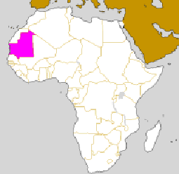
Located between the 5° and 17° of the West longitude meridians and the parallels 15° and 27° of the Northwest Africa, Mauritania is based on both complex and varied geological bedrock (West African Craton) whose the mineral interest is confirmed every day.
The geological Mauritanian context cut down to four main sets:
The crystalline basement
The former basement corresponds to the western part of the West African Craton. It is composed of land dated to the Archaic (approximately 2.7 Ga[1]) and Proterozoic (approximately 1.7 Ga).
The Archaic lands are well represented at the level of the R’guibat Ridge which covers the North of the country and to extend under the ancient sedimentary basins (the Tinduf basin).
All Proterozoic, made up of the volcanic and terrigenous formations drowned in huge masses of granitoid, comes un-conformably overlies Archaic basement.
The Taoudenni basin
The Taoudenni basin covers the East half of the country. The formations are continental sedimented un-conformably on the ancient basement or filed under low slices of marine water. Their thickness does not exceed 3000 m and their age extends upper Proterozoic (Precambrian, about 1 Ga) to the present.
This sedimentary cover the recorded traces of two large glaciations, the late Precambrian (approximately 600 Ma), and at the end of the Ordovician (approximately 440 Ma).
The Mauritanides chain
This chain extends between the 15th and the 20th parallels, between the R’guibat Ridge and Guinea. It is the border of the West African Craton. It is formed of Crystalline and Metamorphic Hercynian material’s age (between -800 and -250 Ma).
Some important tectonic lateral movements overlap it.
The Senegalo-Mauritanian coastal basin
It constitutes the basin of passive margin along the Atlantic Ocean. The bedrock is Pre-Mesozoic and to extend gently to the West. The marginal basin is consisting of the secondary and tertiary land (Continental Merging and Continental Terminal) will therefore in thickening towards the West. The major part is covered by the Quaternary sand with a few "Windows" of diapers salt.

Major geological units in Mauritania
On the mining plan:
The genetically substances related to the R’guibat Ridge and in the Arc of the Mauritanides are the iron in its most common forms (the hematite, the oligiste, the magnetite, the ankerite...), the type of BPGC association’s, the nickel, the titanium, the chromium, the platinoid, the gold, the silver, the uranium and the diamond
The sedimentary basin of Taoudenni is the preferred tank of hydrocarbons (Gas and oil);
The Senegalo-Mautitanian basin or the coastal sedimentary basin contains the iron, the native sulphide, the gypsum, the phosphate, the deposits of the Missipi Valley and Red-bed types, etc.
In view of these data supported by evidence of many deposits and mining indices, Mauritania appears as a country to indisputable mining vocation.